Eslie the Lesser Stone Circle
Clan Strachan Scottish Heritage Society, Inc.
By James A. Strachan, MBA, FSAScot, Seannachie
NGR: NO72248 92165
Printed: 1 June 2025
Last Revised: n/a
Download pdf
Page visits: 439
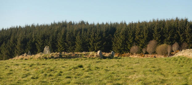
the 10.5 acres was acquired by the Clan Strachan Charitable Trust on 14 August 2025, Eslie the Lesser (or Eslie Minor, Eslie North, West Mullo, or Eslie the Less) is a scheduled ancient monument, classified by Canmore (ID 36703) as a Neolithic ring-cairn, probably surrounded by a stone circle. Archaeological excavations state that Eslie the Lesser had probably been a large stone cist (burial chamber).
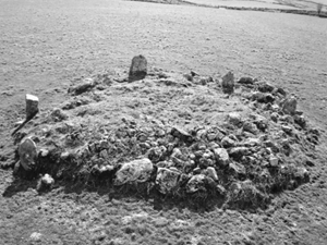
Image from Canmore
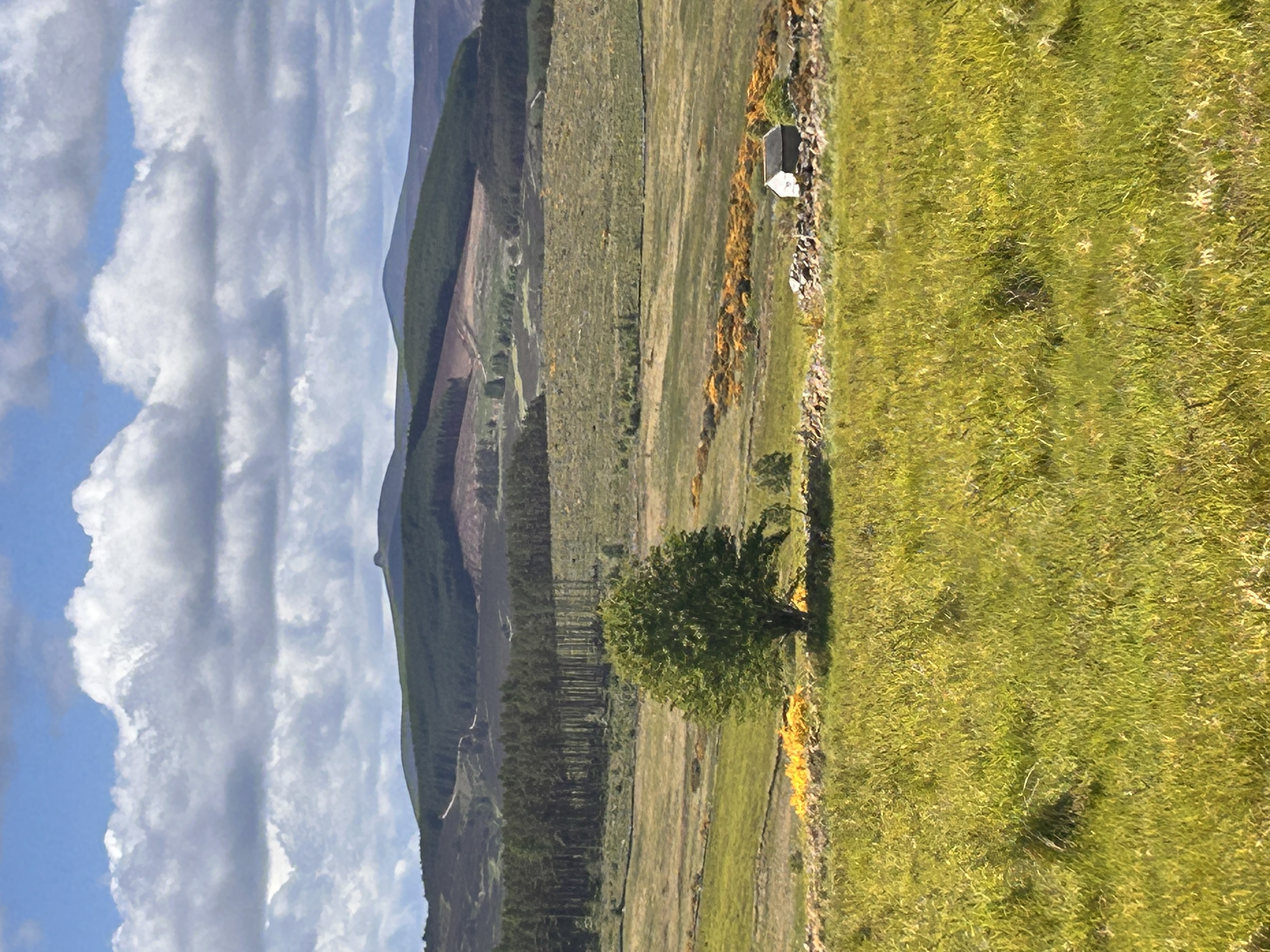
Eslie the Lesser lies 580 metres east-south-east of Eslie Farmhouse, and is gracefully nestled on 10.5 acres of gently sloping agricultural land that opens to the south-south-west. The tranquil setting offers peaceful, sweeping views across the enchanting landscape of the Lower Deeside, with the distant silhouette of Clachnaben on the horizon and the historic Eslie the Greater stone circle in the distance adding to the property's mystic, timeless and romantic charm.
Click To Enlarge
Facing South from Eslie the Lesser
Of the three stone circles in the area, Eslie the Lesser stands out for its breathtaking views. Surrounded by rolling hills and open skies, it offers, by far, the most picturesque and serene setting - a perfect spot for those seeking both history and natural beauty.
The inner ring cairn of Eslie the Lesser measures 8.5m in diameter by a maximum of 0.6m in height. There is a large hollow 4.4m in diameter at its centre (possibly caused by excavation in 1873). [1]
There are two outer kerbstones (1.2m long by 0.4m high) on the SW and two others on the SSE, but the latter may be displaced.
The outer stone circle measures 12.5m in diameter and has been reduced to six stones from a probable original total of eight or nine (the missing stones lying on the N arc). [1]
Two of the stones (only the W is upright) form a pair set close together on the S side of the circle; the W slab measures 1.2m by 0.25m at the base by 1.5m in height, the fallen E slab 1.8m in length by 0.25m in thickness and must have stood at least 0.9m in height. The other stones in the circle range from 1.1m to 1.4m in height.[1]
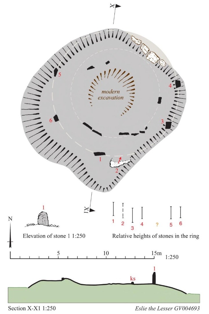
There is no recumbent setting as such, but two slabs were set up close together on the south, and though the eastern (stone 2) has fallen, at about 1.45m in height the western. (stone 1) would have appeared to be the tallest in the ring. The other four stones (3-6) range from 1.1m to 1.5m in height, but their tops are all roughly at the same level. [2]
The cairn within the interior of the circle is rather more irregular in shape and transversely over a kerb of slabs and boulders, the largest of which is in the southern quarter and over 1m in length. [2] [3]
The centre of the cairn was dug out, probably in 1873 by Robert Angus Smith, though he believed that it had already been disturbed and he found no evidence of an inner court (1880, 303-4). [2] As it appears today, the internal cairn is set on a much larger flat-topped mound measuring about 17m across and rising about 0.8m above the level of the surrounding field.
At least the upper portion of this mound is probably an ancient construction, forming a platform beneath the stone circle, but the addition over the years of field-cleared stones has largely obscured its original size and shape. [2]
Some have suggested the fallen (stone 2) is a recumbent stone. However, archaeologists argue that given the placement of the stones, this is unlikely. [2]
Eslie the Lesser is dated, according to Aberdeenshire Historic Environment Records, with a 100% probability to between 4000 to 2500 BC.[4] The Neolithic period is characterised by the beginning of human settlements. People learned to cultivate plants and domesticate animals for food, rather than rely solely on hunting and gathering.
Stone circles served multiple purposes. As for Eslie the Lesser, archaeological excavations confirm the interior ring cairn served as a burial cist, almost certainly for an important tribal leader. It is further possible, given the outer stone circle, the site may have also been used for religious ceremonies, as an astronomical observatory, and/or for social gatherings.
ARTICLE SOURCES
[1] Canmore, ID 36703. Eslie The Lesser. http://canmore.org.uk/site/36703
[2] Welfare, A. (2011) Great Crowns of Stone: The Recumbent Stone Circles of Scotland. Edinburgh. Page(s): pp. 515-7. Royal Commission on the Ancient and Historical Monuments of Scotland (RCAHMS) Shelf Number: A.1.7.WEL. https://archive.org/details/great-crowns-of-stone-1/page/515/mode/1up?q=%22Eslie+the+Lesser%22
[3] RCAHMS. (1984b) The archaeological sites and monuments of North Kincardine, Kincardine and Deeside District, Grampian Region, The archaeological sites and monuments of Scotland series no 21. Edinburgh. Page(s): 10, No. 20 RCAHMS Shelf Number: A.1.2.ARC/21 https://i.rcahms.gov.uk/canmore-pdf/WP00007530.pdf
[4] Aberdeenshire Historic Environment Records: https://online.aberdeenshire.gov.uk/smrpub/master/detail.aspx?tab=period&refno=NO79SW0001
Fair Use Disclosure
The purpose of this publication is exclusively for non-commercial educational purposes and not for resale. Copyright Disclaimer under section 107 of the Copyright Act 1976, allowance is made for "fair use" for purposes such as criticism, comment, news reporting, teaching, scholarship, education and research. Fair use is a use permitted by copyright statute that might otherwise be infringing.